
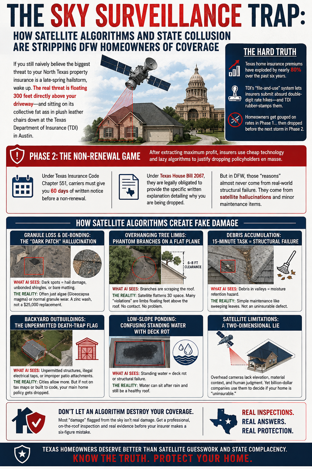
If you still naively believe the biggest threat to your North Texas property insurance is a late-spring hailstorm, wake up. The real threat is floating 300 feet directly above your driveway—and sitting on its collective fat ass in plush leather chairs down at the Texas Department of Insurance (TDI) in Austin.
Over the past six years, Texas home insurance premiums have exploded by nearly 80 percent, giving North Texas the dubious honor of paying some of the most outrageous rates in the entire nation. How does an industry pull off this kind of daylight robbery? With the direct, enthusiastically rubber-stamped permission of TDI. Operating under the state’s cozy “file-and-use” regulatory system, TDI acts less like a public consumer watchdog and more like a high-dollar concierge service for insurance underwriters. Insurers submit absurd double-digit rate hikes, TDI nods along like a dashboard bobblehead, and homeowners get handed the tab.
Having systematically gouged regular Texans out of their hard-earned equity, insurance carriers have moved on to phase two of their cynical little game: dropping policyholders en masse before the next storm system rolls through. But why pay actual, competent field adjusters to walk a roof when you can fire them all and replace them with dirt-cheap satellite photography, fixed-wing passes, and third-party drone fleets running primitive, bottom-of-the-barrel AI algorithms?
Under Texas Insurance Code Chapter 551, carriers must give you 60 days of written notice before a non-renewal. Furthermore, under Texas House Bill 2067, they are legally obligated to provide the specific written explanation detailing why you are being dropped. But when those letters hit DFW mailboxes, the “reasons” almost never stem from real-world structural failure. They trace back to minor maintenance items that lazy homeowners neglected—or low-angle, two-dimensional aerial cameras that completely hallucinated damage out of thin air.
Granule Loss and De-bonding: The “Dark Patch” Hallucination
Aerial AI looks for basic color contrast shifts, roof shadows, or dark spots, automatically flagging those areas as catastrophic hail damage, unbonded shingles, or bare fiberglass matting. The ground reality? A brainless algorithm cannot tell the difference between functional asphalt erosion and harmless Gloeocapsa magma, the cosmetic black algae staining every third roof in humid North Texas. Furthermore, a satellite camera thousands of feet in the air cannot physically test for seal-strip adhesion. A roof flagged by a lazy underwriter as gearing toward structural collapse is frequently just an eight-year-old roof that needs a hundred-dollar zinc wash, not a $25,000 asphalt replacement.
Overhanging Tree Limbs: Phantom Branches on a Flat Plane
This is the single biggest victim of cheap, flat-plane satellite technology. Direct vertical overhead shots collapse three-dimensional space into a flat 2D picture. The result? A perfectly innocent tree canopy looks like it is physically crushing your roof deck. While tree branches actually scraping a roof violate basic standards of practice by providing a direct highway for roof rats and scrubbing off protective granules, top-down satellite views completely lack vertical depth perception. An oak branch floating six to eight feet cleanly above a ridge line appears to be scraping the shingles from an overhead camera. Without an in-person elevation assessment, carriers issue bogus non-renewals for phantom limbs that aren’t even touching the damn house.
Debris Accumulation: Marking a 15-Minute Task as a Structural Failure
Aerial scanners spot dark, clumped lines along roof valleys, dormers, and chimney crickets, instantly flagging fallen leaves and post-hail oak tassels as catastrophic moisture retention hazards. While trapped debris can back up water under counter-flashings over time, an automated drone marks a simple fifteen-minute maintenance task like sweeping a valley as an uninsurable structural defect.
Backyard Outbuildings: The Unpermitted Death-Trap Flag
As North Texas cities relax single-family zoning rules, backyards are filling up with cheap, unpermitted detached offices, casitas, and covered patios built by tailgate contractors. Aerial algorithms cross-reference building footprints against municipal tax maps. If a drone flags an unpermitted shed tapped illegally into the main house panel, or a patio cover tied improperly into the fascia without structural ledger framing, insurers drop the primary residence policy entirely due to unmanaged fire and wind-uplift hazards.
Low-Slope Ponding: Confusing Standing Water with Deck Rot
Satellite infrared and optical sensors regularly flag standing water on flat or low-slope roof sections forty-eight hours after a rain event, instantly declaring it active roof deflection or rotting decking. Meanwhile, improper perimeter grading—the undisputed king of slab foundation failures in North Texas clay—gets completely overlooked by the sky cameras until excessive vegetation growth signals moisture pooling near the grade.
How to Smash a Bogus Non-Renewal
If your carrier hits you with an automated non-renewal letter based on 2D satellite images claiming your roof has phantom tree limbs or non-existent damage, do not panic, and do not let a sleazy storm-chasing salesman scare you into signing a massive contract.
Force the Evidence: Demand the exact evidence package under Texas HB 2067. State law requires carriers to provide the specific written justification and source data. They regularly drop coverage using outdated aerial passes, low-resolution garbage, or photos of your neighbor’s property down the street.
Get Ground-Truth Photos: Take date-stamped, eye-level photographs showing the actual vertical clearance between your roof deck and the tree canopy. Prove the 2D flattening effect is a cheap, fraudulent lie.
Hire a Real Roofer, Not a Drone: An automated camera thousands of feet up cannot measure branch clearance, test shingle pliability, check step-flashing integration, or inspect attic decking for active leaks. A licensed, certified, reputable roofing contractor provides an unbiased, ground-truth evaluation of the structural system.
Nail Them with a Rebuttal: Submit a certified rebuttal package with ground photos and a professional evaluation report directly to the carrier’s underwriting appeals department. Then file a formal complaint with the Texas Department of Insurance—if for no other reason than to force TDI’s comfortably numb bureaucrats to actually open a file and force the carrier to manually review the evidence. This might (certainly will) be wasted time, but it could make you feel better.
Documented physical verification by a real human roofer forces the carrier to review the file manually or gives you the exact paperwork needed to secure coverage elsewhere in the private market before being forced into the state insurance pool. Don’t let a blind algorithm sitting alongside a toothless, captured state regulator judge your home’s structural integrity when an educated homeowner with ground-level proof can disprove a drone camera every single time.


